What is the difference between Cap-Ferrat, Beaulieu, and Èze?
Saint-Jean-Cap-Ferrat is a lush 2.5 km² peninsula dotted with Belle Époque villas, nicknamed the «billionaires» cap." Beaulieu-sur-Mer stretches along the Bay of Ants, a protected microclimate that is home to the Villa Kérylos. Èze, perched 429 meters high on its limestone cliff, plunges into the sea via steep walls invisible from land.
Three geographies, three identities
Each of these three sites is distinguished by a specific geography:
- Cap Ferrat wooded peninsula, 12 km in circumference, protected from winds by its arc shape
- Beaulieu : south-southeast facing, open bay, sheltered by the buttresses of Mont Boron to the west
- Èze vertical limestone cliff that plunges steeply into the sea, topped by a medieval village
Three overlapping eras
The three sites did not develop during the same period:
- Èze dates from antiquity of the Ligurians and the medieval period (Saracen stronghold)
- Beaulieu developed in the 19th century as an Anglo-Saxon winter resort.
- Cap-Ferrat becomes luxurious during the Belle Époque, after the arrival of the railway in 1864
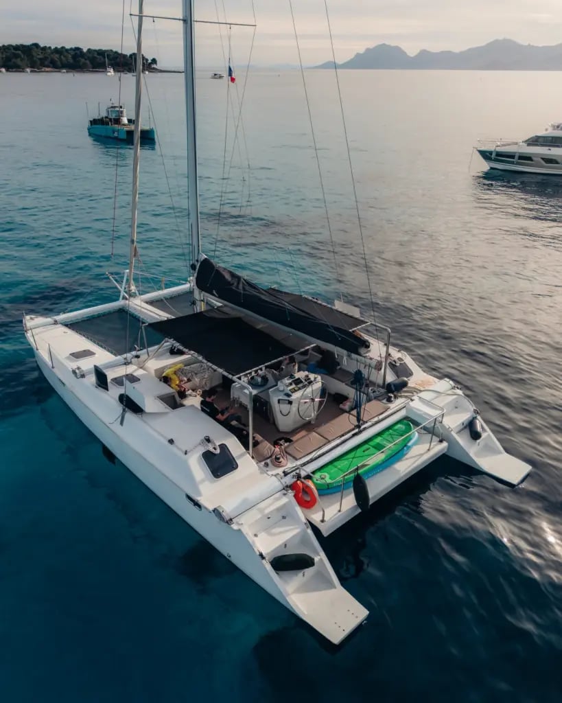
This geographical and historical sequence makes up an ideal section to discover during a Boat trip from Nice to Saint-Jean-Cap-Ferrat, which is far from the peninsula and offers the best angles on the three atmospheres.
Cap-Ferrat: The Peninsula of Belle Époque Villas
The Saint-Jean-Cap-Ferrat peninsula is recognizable by its umbrella pines, dense pine forests, and pink roofs. It is home to one of the highest concentrations of still-preserved Belle Époque villas in the world. The perimeter, traversed by an 11-kilometer coastal path, alternates between private coves and rocky points.
Five iconic villas visible from the sea
- The Villa Ephrussi de Rothschild (1912), reigning at an altitude of 80 meters, owned by the Academy of Fine Arts
- The Leopold Villa, former property of King Leopold II of Belgium
- The Villa Santo Sospir, nicknamed «the tattooed villa» by Jean Cocteau
- The Maryland Villa, formerly owned by Microsoft co-founder Paul Allen
- The Villa The Flower of the Cape, where David Niven and Charlie Chaplin lived
Three historic beaches
The peninsula has three main beaches, each with a distinct atmosphere:
- Acceptable, family beach in the northwest, facing Mount Boron
- Cros dei Pin, pebble beach to the south, frequented by walkers
- The Dove, sandbaths to the east, in the Gulf of Saint-Hospice
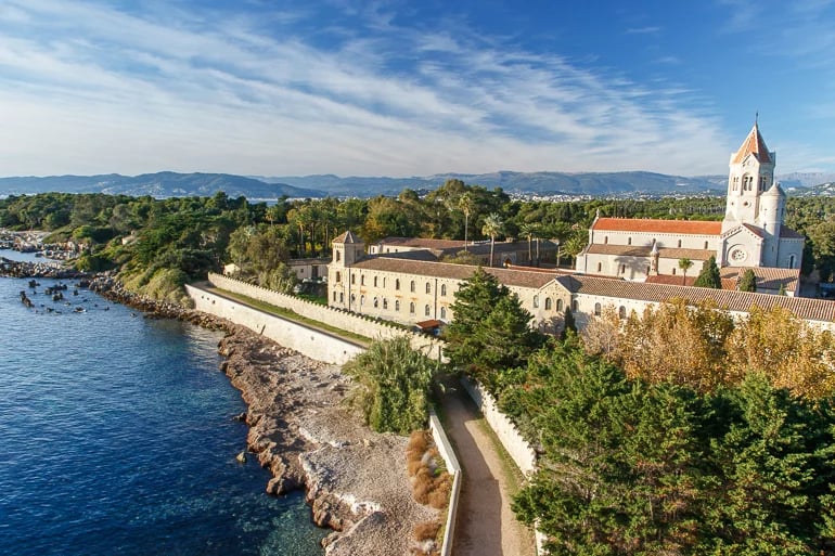
Saint-Hospice Point
The extreme south of the peninsula is home to the medieval Saint-Hospice chapel (11th century), a monumental bronze cross from 1903, and a Belgian military cemetery inaugurated in 1917. The site can be reached on foot via the coastal path, or by boat during a coastal withdrawal From Nice.
Beaulieu-sur-Mer: The Classic Bay with Hellenic Gardens
Located in the Bay of Ants, between Cap Ferrat to the west and Pointe de Saint-Sauveur to the east, Beaulieu-sur-Mer benefits from a microclimate recognized as one of the mildest in Europe. This uniqueness made its fortune in the 19th century.
Little Africa, exceptional microclimate
The neighborhood known as «Little Africa,» nestled against the cliffs of Beaulieu, experiences winter temperatures 2 to 3 degrees higher than the regional average. This mildness is due to:
- The’south-facing from the bay, maximizing winter sun exposure
- The Protection of the Prealps, which block the cold north winds
- The’thermal effect limestone cliffs, which give off heat at night
This unique feature attracted wealthy Anglo-Saxon clientele from as early as 1880, fleeing the northern winters. In less than twenty years, the resort became one of the favorite destinations for British aristocracy and American magnates.
Villa Kérylos, an Ancient Greek Dream
Built between 1902 and 1908 by the archaeologist Theodore Reinach and the architect Emmanuel Pontremoli, the Villa Kérylos faithfully reproduces an ancient Greek dwelling from the 2nd century BC, inspired by houses in Delos. Reinach bequeathed the villa to the Institut de France upon his death in 1928; it is open for visits today.
The Customs Officers' Path
A coastal path connects Beaulieu to Saint-Hospice point on Cap-Ferrat in less than an hour. It offers one of the most comprehensive views of the bay, but the private villas are only partially visible from this walking route. Boat rental with skipper allows you to follow the same coast at a complementary angle and reveals coves inaccessible on foot.
Èze: the eagle's nest perched at 429 meters
Èze-Village is a medieval eagle's nest perched at 429 meters above sea level above the Mediterranean, between Nice and Monaco. Seen from the sea, the village appears as a distant point clinging to the limestone cliff, almost inaccessible by land.
A stronghold of Ligurian origins
The site has been inhabited since the 2nd century BC by the Ligures, a pre-Roman people. The Phoenicians are said to have erected a temple there to the goddess Isis (from which the name would come Èze). The castrum transformed into a Saracen stronghold in the 9th century, then into a fief of the Counts of Provence from the 12th century onwards.
1706: Louis XIV dismantles the castle
During the War of the Spanish Succession, Louis XIV had Eze's fortifications razed to prevent their reuse by Savoy. The ruins remained as they were for 240 years, until a landscaping redevelopment project.
The Exotic Garden on the Ruins (1949)
In 1949, the botanist Jean Gastaud, conservator of the Exotic Garden of Monaco, designs a succulent plant garden on the site of the dismantled castle. The path spirals around the remains, offering a 360° view of:
- Cap-Ferrat to the west
- The Monegasque peninsula in the east
- Mount Bego and the Alps to the north
- Corsica on days of exceptional mistral
Friedrich Nietzsche and the Way of Zarathustra
The path that descends from the village to Èze-Bord-de-Mer is named the Nietzsche Path. The German philosopher is said to have composed the third part of’Thus Spoke Zarathustra in 1883, during repeated stays at the Pension Zollinger between 1881 and 1888. The steep trail descends 2.5 km with a 400-meter drop in elevation.